Signatories of the NFDI4Earth FAIRness and Openness Commitment pledge to support NFDI4Earth’s mission, products, and services. The signature of members and/or representatives of the Earth System Sciences community is a public signal of agreement with the goals and values of the Commitment. By collectively supporting the Commitment, the signatories realise NFDI4Earth as a community of practice, taking into account the full range of expertise and all relevant user groups of Earth System Sciences for a sustainable shift towards more FAIR and Open Research.
As signatories...
Alfred-Wegener-Institute (AWI)
Contact: Anke Allner
https://www.awi.de

Federal Agency for Cartography and Geodesy (BKG)
Contact: Marcus Brühl
https://www.bkg.bund.de
Leibniz Supercomputing Centre (LRZ)
Contact: leitung@lrz.de
www.lrz.de
Leibniz Centre for Agricultural Landscape Research (ZALF)
Contact: Carsten Hoffmann
https://www.zalf.de
SDI Germany (GDI-DE) represented by the Steering Committee SDI Germany
Contact: Katrin Weke
https://www.gdi-de.org
TUD Dresden University of Technology
Contact: Lars Bernard
https://tu-dresden.de/
GFZ Helmholtz Centre for Geosciences
Contact: Wolfgang zu Castell
www.gfz.de
 Your name, group, or organisation is missing? Sign the commitment here: nfdi4earth.de/commit.
Do you have any problems with signing or is your data incorrect? Please contact the NFDI4Earth Helpdesk at helpdesk@nfdi4earth.de.
Your name, group, or organisation is missing? Sign the commitment here: nfdi4earth.de/commit.
Do you have any problems with signing or is your data incorrect? Please contact the NFDI4Earth Helpdesk at helpdesk@nfdi4earth.de.
Full citation: NFDI4Earth Consortium. 2024. NFDI4Earth FAIRness and Openness Commitment (NFDI4EarthDeliverable D4.2.1). NFDI4Earth Community on Zenodo. https://doi.org/10.5281/zenodo.10123880.
You can provide anonymous feedback at https://redcap.zih.tu-dresden.de/redcap/surveys/?s=YKTL79MPMEHDTMAK.
Show your support of the NFDI4Earth FAIRness and Openness Commitment and add the NFDI4Earth Commitment Badge to your website.
![]() The badge is published under an open license for easy re-use. See the Materials page for licensing information and different file formats: https://nfdi4earth.geo.tu-dresden.de/member-area/materials
The badge is published under an open license for easy re-use. See the Materials page for licensing information and different file formats: https://nfdi4earth.geo.tu-dresden.de/member-area/materials
The FAIRagro consortium with more than 30 partners is building a FAIR (Findable, Accessible, Interoperable, Reusable) research data management system for the agrosystems research community. They are developing the tools and workflows to lay the foundations for sustainable crop production – now and in the future. In March 2025, FAIRagro published their version of the NFDI4Earth Commitment with minor adjustments to address the agro community.
https://fairagro.net/en/commitment
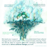
Without cultural change there is no sustainable research data sharing. That is why in 2023, members of several NFDI consortia came together to discuss the challenges and opportunities of sharing research data with and through the NFDI. In several online workshops and publications they investigate how cultural change can promote use of infrastructures, and how infrastructures can promote cultural change. Because data shall grow - and we with it.
https://cc-by-us.gitlab.io/
There are various ways how organisations can implement the NFDI4Earth FAIRness and Openness commitment. These ways depend on the organisation type, the current policies regarding FAIRness or Openness, the policies of parent organisations, ... to name just a few. The NFDI4Earth Commitment team facilitates an exchange between institutional signatories on their actions and goals. Your institution can join this exchange as a signatory, too!
Here are some examples for activities an organisation can take, in part based on the internal plans for existing signatories:
Find more examples in the Living Handbook article on the NFDI4Earth Commitment: https://onestop4all.nfdi4earth.de/result/lhb-docs-N4E_FAIRness-and-Openness-Commitment.md
This work has been funded by the German Research Foundation (DFG) through the project NFDI4Earth (TA4 M4.2, DFG project no. 460036893, https://nfdi4earth.geo.tu-dresden.de/) within the German National Research Data Infrastructure (NFDI, https://www.nfdi.de/).
We thank all contributors from the NFDI4Earth community and beyond for their questions, feedback, edits, and their inspirational work that this commitment is grounded on. People who have agreed are listed in alphabetical order below using CRediT and as contributors on the Zenodo record. We also extend our sincere thanks to all unnamed contributors for their inputs, be they small, indirect, or given in passing, from the NFDI4Earth community and beyond, especially the members of the NFDI4Earth steering group and the participants of the in-person workshop "Towards a Cultural Change in ESS RDM" at the 3rd NFDI4Earth Plenary in Dresden in May 2024.
Lars Bernard - Conceptualization, Funding acquisition, Supervision, Writing – review & editing
Peter Braesicke - Writing – review & editing
Kirsten Elger - Conceptualization, Methodology, Writing – review & editing
Frank Oliver Glöckner - Supervision
Christina Habermehl - Writing – review & editing
Dominik Hezel - Writing – review & editing
Andreas Hübner - Conceptualization, Methodology, Writing – review & editing
Carsten Keßler - Writing – review & editing
Marthe Klöcking - Supervision, Writing – review & editing
Melanie Lorenz - Conceptualization, Methodology, Writing – original draft, Writing – review & editing
Daniel Nüst - Conceptualization, Methodology, Writing – original draft, Writing – review & editing
Najla Rettberg - Supervision
Thomas Rose - Writing – review & editing
Markus Schmalzl - Writing – review & editing
Jörg Seegert - Conceptualization, Methodology, Writing – original draft
Monika Sester - Writing – review & editing
Claus Weiland - Writing – review & editing
